GINVE.HD
Full web intervention requests management
What is GINVE.HD
GINVE.HD is a web platform supplemented by GINVE.CLOUD to manage, enter and monitor interventions’ requests received from different channels (App, Form Web, phone calls, e-mails, etc).
All alerts are directed to the proper office or skilled technician, no matter the number of maintainers involved in the managing of the territorial heritage. In addition to the sender’s details, the alert must show the typology, the geographical site shown on Google Maps® and possible additional notes. From its receipt to the conclusion of the operation, every alert shows all activities performed including the timing and the resources involved.
The application allows the operator to monitor the progress of the request in real time.


What you can do with GINVE.HD
GINVE.HD manages all alerts received from App., Web, telephone or e-mail and submit them to the proper municipal office or the maintenance company according to the signaler-user (technicians, emergency workers, common people, etc) and the type of request; this will help optimizing time and management frames of all interventions.
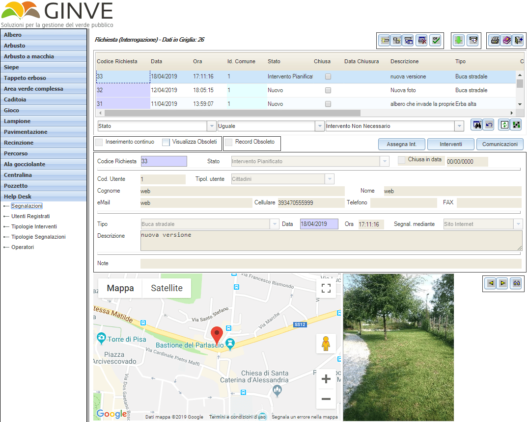
GINVE.HD shows the list of all alerts received, it suffices to select one to view all info related to it (progressive, date, origin, status, type and signaler’s info, site on the map, picture, description, notes and interventions appointed) and start managing right away.
According to the type of emergency, the platform deploys the Alerts’ management function and enables to launch automatically specific workflows to simplify and automate the signaling process and prioritize urgent alerts.
GINVE.HD can track all documents related to the request of intervention, save all answers provided by the operator, all steps and operators involved and create reports on the progress of the service and the management of all requests.


GINVE.HD - How it works
GINVE.HD works with a regular internet browser (Google Chrome, Microsoft Edge, Firefox e Safari) and an internet connection. No additional software installation is required.
A username and a password are needed to access the platform and according to the user’s privileges several functions are available. The simple and intuitive interface enables to select a specific alert from a navigable list or filter and rapidly research the alerts through dedicated research fields.
A simple click on the alert allows to visualize the information listed in the chart underneath including the progress or the possible submitting to a third operator should the alert not be part of the institution’s duties.
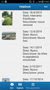
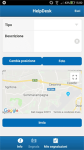
As previously mentioned, alerts can be sent to GINVE.HD through different channels. When it is received from the App, the alert will include the signaler’s information, the type, the site on Google map®, picture and description. These alerts enable the signaler to check the progress, receive communications from the alerts’ management service and visualize the list of requests sent out.
Requests sent through web forms require the user to register prior the enabling to send alerts. New registrations can be activated automatically through the system or via request to the operator after checking the correctness of the info entered.
When accessing the web with the username and the password, the user can send alerts by filling in a simple form and is qualified to investigate the archive and the progress of previous requests.
The synchronization form (GINVE.FIELD) enables to export the full map of the territory or part of it in the palm, thus allowing the exportation of more areas and a separate management. Fragmentation of the area saves time during the loading process and the management of data in the palm.


